Last modified: 2026-09-12 by martin karner
Keywords: elat | eilat | iriyat elat | text: hebrew (blue) | anchor | cogwheel | fort |
Links: FOTW homepage |
search |
disclaimer and copyright |
write us |
mirrors
![[Municipality of Eilat, 2:3 yellow variant (Israel)]](../images/i/il-eilt2.gif) image by Dov Gutterman 2:3    Emblem adopted 1st June 1972 |
![[flag]](../images/i/il-eilat2.jpg) (source) |
See also:
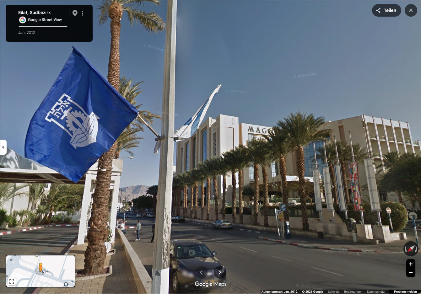
The city of Eilat uses as flag a blue logo on many
backgrounds. The one on the city hall is yellow but there are
also white and light blue.
Dov Gutterman, 15 April 1999/15 May 1999/13 April 2000
Eilat is the southmost point of Israel on the shore of the Red Sea. Eilat (sometimes written also as Elat) is a resort place with many attractions and a port. In Eilat there are border passes to Egypt and Jordan. Eilat was established in 1949 and became a municipality in 1959. It was established on a site of a desert police station named Um Rashrash (see the ink flag story). Eilat is named after a biblical port-city and has 49'000 inh.
Mr. Yehuda Kaplinski, assistant to the mayor wrote me as follows:
I made the image with a yellow field since this is the flag that I saw in the city hall. In my opinion it was 2:3, but he said 70 × 150 cm which is 7:15 ratio which seems to be wrong.
Dov Gutterman, 19 August 2001
The municipal emblem was published in the official gazette (Rashumot),
YP 1827, 1 June 1972.
Dov Gutterman, 4 September 2001
I had another opportunity to check it ... and it is 2:3.
However, Eilat joined the other ports and now a blue
flag (with no inscription) is hoisted in front of the city hall.
Dov Gutterman, 19 June 2003
Elat appears in the Bible (2 Kings 14:22
and 16:6). There
are three possible explanations for the origin of its name: Ela
(name of a tree – Pistacia), Eyal (strength –
after the strong storms) and Ayal (deer).
The Eilat emblem appeared on a stamp
issued on 24 March 1965.
According to the official
website [retrieved], the explanation of the emblem is as follows:
♦ Timeline of Eilat (until 1949) (eilat.muni.il, Hebrew [retrieved] | English translation)
![[Municipality of Eilat, 2:3 blue variant (Israel)]](../images/i/il-eilt3.gif) 2:3
2:3
image by Dov Gutterman
♦ picture
![[Municipality of Eilat (Israel)]](../images/i/il-eilt1.gif) 7:15
7:15
image by Dov Gutterman
![[CoA]](../images/i/il-eilat)1.png) (source, source) |
![[CoA]](../images/i/il-eilat)2.png) (source, source) |