
Last modified: 2013-04-27 by ian macdonald
Keywords: sao paulo | guatapará |
Links: FOTW homepage |
search |
disclaimer and copyright |
write us |
mirrors
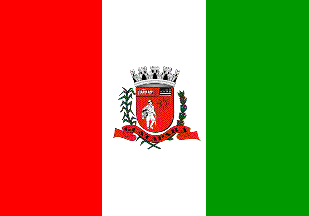 image by Ivan Sache, 4 April 2013
Guatapará was established on the territory of the Guatapará Estate,
founded in 1865 by the coffee grower Martinho "Martinico" Prado da
Silva Júnior. He named the new settlement Albertina, as a tribute to
his wife. The district of Guatapará was established by Decree No.
9,775 of 30 November 1938, as part of the municipality of Ribeirão
Preto. Originally located in the Guatapará Estate, the seat of the
district was transferred to the railway station of Guatapará by
Municipal Law no. 246 of 8 September 1962.
The municipality of Guatapará was established on 9 January 1990.
http://www.guatapara.sp.gov.br - Municipal website
The flag of Guatapará is vertically divided red-white-green with the municipal coat of arms in the middle.
Photos
http://blogdogasparini.blogspot.fr/2011/12/festa-da-colheita-da-colonia-mombuca-e.html
http://andreluiz65.blogspot.fr/2011/02/andre-discursa-em-
guatapara.html
Ivan Sache, 4 April 2013