
Last modified: 2023-03-25 by rob raeside
Keywords: karbinci |
Links: FOTW homepage |
search |
disclaimer and copyright |
write us |
mirrors
![[Flag]](../images/m/mk-karb.gif) image by Valentin Poposki, 21
September 2021
image by Valentin Poposki, 21
September 2021
based on photo from https://mojaopstina.mk
See also:
The municipality of Karbinci (4,012 inhabitants; 229,7 sq. km), located in zastern North Macedonia, is made of the 29 settlements of Argulica, Batanje, Vrteška, Golem Gaber, Gorni Balvan, Gorno Trogerci, Dolni Balvan, Dolno Trogerci, Ebeplija, Junuzlija, Kalauzlija, Karbinci, Kepekčelija, Kozjak, Krupišste, Kurfalija, Kučilat, Kučica, Mal Gaber, Mičak, Muratlija, Nov Karaorman, Odžalija, Pripečani, Prnalija, Radanje, Ruljak, Tarinci and Crvulevo.
Ivan Sache, 11 Avril 2010
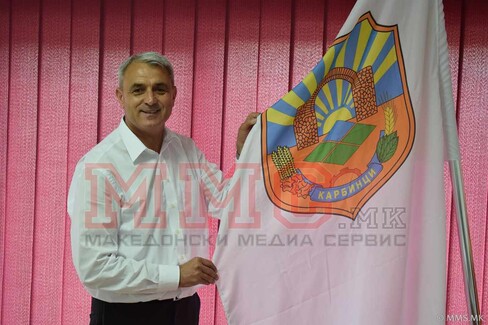
The Municipality of Karbinci adopted the white flag with municipal arms on it.
Valentin Poposki, 21 September 2021
The coat of arms features the monumental gate of the Byzantine town of
Bargala.
The late antique city of Bargala is situated 10 km southeast of
the city of Štip, at the foot of Mt. Plačkovica. Its name as a toponym has a
Thracian component and, taken as a whole, it means "overflowing water". In the
7th and 6th centuries BC this area belonged to the territory settled by the
Paeonian tribe of Derrones who were among the first tribes in the world that
minted silver coins.
Astibos is the antique name of river Bregalnica in
which, according to the antique historiographer Polienus, the Paeonian kings
took ritual baths at coronation.
The first site of the city of Bargala
was 1 km south of the river, near the location known as Hamče, near the village
of Karbinci. On this site, remains of walls, a xenodocheion (inn), a basilica
and a huge stone dating from 371 with an inscription which refers to the
building of the city gates of the city of Bargala in the Roman province Dacia
Mediterranea. By the 5th century AD, the city had already been firmly
christianized, and its Bishop Dardanius was a participant from Macedonia Prima;
his name is recorded in the acts of the ecumenical council of Chalcedon in 451.
The instability in the late Roman empire in the 4th and 5th centuries caused
by the barbarian onslaughts from the north forced the inhabitants of the city to
withdraw 4 km towards the south, at the foot of Mt. Plačkovica and the site
known as Kozji grad, where they continued living their urban style of life.
Here, the fortified early Byzantine city of Bargala, covering an area of 4.7
hectares, additionally secured with 6 defensive towers, was built after the
model of late Roman castrums.
The city was accessed through the double
(dipilon) main gate (porta principalis) which was exceptionally well guarded. it
was built on the northwest rampart which was up to 12 m high; inside the city,
there was a sewage system which supplied the more important buildings and
fountains with water that was brought from the mountain.
At present, several
public buildings have been discovered, as well as shops and workshops that
served the citizens in the period between the 5th and the beginning of the 7th
centuries. The most impressive structure is the three-nave episcopal basilica
which was accessed by a steep and high stairway; the three entrances (tribelon)
led to the lavishly decorated interior of this temple. The skill of the local
stonemasons and mosaic artisans is evident, especially in the manufacture of the
architectural elements, church mobiliary and floor mosaics panels.
The
artistic style is characteristic of the early Byzantine and christian art of the
5th and 6th centuries in Macedonia. On one of the capitals, Hermias, Bishop of
Bargala, carved a prayer for salvation; he was probably also the donor of the
church. a baptisterium with a piscina in which christians were baptized has been
discovered next to the north wall of this building. a single-nave chapel was
added next to the south wall of the basilica. the episcopal residence stood on
the northwest side; it had a small thermal bath, next to which a larger one was
built for a larger number of visitors. A series of chambers were built near the
northwest and southeast ramparts, which are believed to have been used as
workshops and shops, as well as dwelling places.
The citizens carried out
their funeral and spiritual rites outside the city walls (extra muros);
therefore, 85 m north of the main gate, a basilica was used in the period
between the 4th and 6th centuries. The vaulted tomb discovered east of this
sacral building was also part of the citizens’ spiritual life.
The
section of the city that has been excavated (less than 1/10 of the actual size)
yielded several hidden hoards of coins, luxurious objects and complete artisan
tool kits. In the darkest historical period that lasted from the 7th to the end
of the 9th centuries, small groups of people settled among the ruins of the city
and the city ramparts. They led a rural life and their material culture is much
less significant than that of their predecessors, the Rhomeioi.
In the 10th
century, a rural settlement known as Kozjak was formed on the site near the
antique city of Bargala and river Kozjačka; it survived until the 19th century.
A small church dedicated to St. George, whose architectural and artistic
achievements hold a significant place in Byzantine art was also built on this
site.
http://haemus.org.mk/wp-content/uploads/2013/04/Archaeological-sites-in-Republic-of-Macedonia.pdf
Macedonian cultural heritage.Archaelogical sites.
Photo
https://commons.wikimedia.org/wiki/File:Bargala_(7438444172).jpg
Ivan Sache, 22 September 2021
.jpg)